import sys
import numpy as np
import xarray as xr
from rasterio.enums import Resampling
import odc.geo
from odc.geo.xr import xr_reproject
from odc.geo.geobox import GeoBox, BoundingBoxLazy resampling
Example on how to lazily resample a xarray.Dataset or xarray.DataArray with dask using odc.geo.xr.xr_reproject
print(sys.version)
print(xr.__version__)
print(odc.geo.__version__)
3.13.1 | packaged by conda-forge | (main, Dec 5 2024, 21:23:54) [GCC 13.3.0]
2025.3.1
0.4.10The following function is only to simluate that the crs, while initially present on the opened dataset, can get lost easily along the way in workflows, leading to the reprojection to fail. This is not a shortcoming of xarray or xr_reproject, but I want to document it, as this happened to me several times before.
def replace_2_by_0(da: xr.DataArray) -> xr.DataArray:
    """Replace 2s by 0"""
    return da.where(da != 2, 0)
ds_webcam = xr.open_zarr("./data/webcam_snow_cover.zarr")ds_webcam["nodata"] = np.nanCheck that important info on crs is present
assert ds_webcam.odc.geoboxassert ds_webcam.odc.crsConstruct geobox needed for xr_reproject
xmin, xmax = 656320.0, 661020.0
ymax, ymin = 5213480.0, 5209240.0

lower_res = 20 # target resolution in meters

epsg_code = 25832
bbox = BoundingBox(left=xmin, top=ymax, bottom=ymin, right=xmax)
geobox = GeoBox.from_bbox(bbox=bbox, crs=epsg_code, resolution=lower_res)Perform computation on dataset
I sometimes use xr.DataArray objects in computations. It is easy to oversee that the data array (here ds_webcam.snow_cover) does not inherit or carry over all the important information (.odc.crs and .odc.geobox) present on the parent dataset object (ds_webcam) when used in computations.
# perform the dummy operation
snow_cover = replace_2_by_0(ds_webcam.snow_cover)
# geobox is present!
assert snow_cover.odc.geobox/home/<user>/miniconda3/envs/satpy/lib/python3.13/site-packages/odc/geo/_xr_interop.py:503: UserWarning: grid_mapping=spatial_ref is not pointing to valid coordinate
warnings.warn(# but the crs is not (as the above warning indicates)
snow_cover.odc.crsTo me this was initially counter intuitive, as the parent dataset has the complete information:
ds_webcam.odc.crsCRS('PROJCS["ETRS89 / UTM zone 32N",GEOGCS["ETRS89",DATUM["European_Terrestrial_Reference_System_1989",SPHEROID["GRS 1980",6378137,298.257222101,AUTHORITY["EPSG","7019"]],AUTHORITY["EPSG","6258"]],PRIMEM["Greenwich",0,AUTHORITY["EPSG","8901"]],UNIT["degree",0.0174532925199433,AUTHORITY["EPSG","9122"]],AUTHORITY["EPSG","4258"]],PROJECTION["Transverse_Mercator"],PARAMETER["latitude_of_origin",0],PARAMETER["central_meridian",9],PARAMETER["scale_factor",0.9996],PARAMETER["false_easting",500000],PARAMETER["false_northing",0],UNIT["metre",1,AUTHORITY["EPSG","9001"]],AXIS["Easting",EAST],AXIS["Northing",NORTH],AUTHORITY["EPSG","25832"]]')Let’s fix that:
snow_cover = snow_cover.odc.assign_crs("epsg:25832")Check source no data value and set correctly
# show that nodata attribute is missing
assert getattr(snow_cover, "nodata", None) is None
# add nodata attribute
snow_cover["nodata"] = np.nanPerform lazy resampling
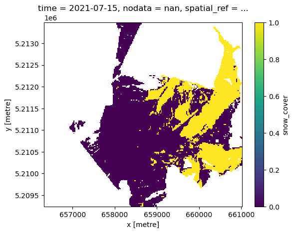
snow_cover_downsampled = xr_reproject(snow_cover, geobox, resampling=Resampling.mode)
snow_cover_downsampled.name = "snow_cover"
Which returns a dask-backed dataarray:
snow_cover_downsampled<xarray.DataArray 'snow_cover' (time: 1, y: 212, x: 235)> Size: 399kB
dask.array<reproject, shape=(1, 212, 235), dtype=float64, chunksize=(1, 212, 235), chunktype=numpy.ndarray>
Coordinates:
* time (time) datetime64[ns] 8B 2021-07-15
nodata float64 8B nan
* y (y) float64 2kB 5.213e+06 5.213e+06 ... 5.209e+06 5.209e+06
* x (x) float64 2kB 6.563e+05 6.564e+05 ... 6.61e+05 6.61e+05
spatial_ref int32 4B 25832
Attributes:
AREA_OR_POINT: Areasnow_cover_downsampled.plot()